top of page


Our Preserves

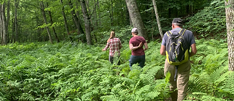
Waldoboro

Brown Family Preserve
South Thomaston

Appleton

Cushing

Owls Head
Warren

Appleton

Searsmont

Montville

Thomaston

Cushing
.jpg)
Cushing

Cushing


Union
Searsmont


Union
South Thomaston
Liberty


Rockland / Thomaston
Union

St. George


Warren
South Thomaston

Union
GHP
The Georges Highland Path (GHP) was designed with the goal of creating a through-hike from Thomaston to Frye Mountain. These trails are part of the GHP. While not owned by the land trust, we maintain sections of these trails, accessible through conservation easements and landowner agreements.

Montville

Warren


Montville
Appleton

Hope
_JPG.jpg)
Rockland

Rockport
Town Trails
These trails are owned and maintained by towns in the Georges River watershed. In some cases, our Georges Highland Path (GHP) runs through these properties.


St. George
St. George
Owls Head


Rockland
St. George
St. George

Thomaston

St. George
The St. George River Trail
The St. George River is the lifeblood of the watershed that winds its way from its headwaters in Lake St. George and Frye Mountain in Waldo County to its mouth where it flows into Muscongus Bay in Knox County. The 51-mile river falls from coastal mountains through rich farmlands, ten towns, and flows through seven lakes.
The St. George River boasts some amazing boating opportunities including fast rips, tranquil pools under nearly closed tree canopies, and six portages. We’ve created a river trail map covering 36 miles for those interested in canoeing and kayaking this beautiful river. The map shows the river in four sections and highlights access points, rapids, portages and historical points of interest. Let’s go paddling!

Georges River Scenic Byway

bottom of page